I actually recorded this video and photos standing on the trail, which is inside the District of Columbia.
Video link:

I actually recorded this video and photos standing on the trail, which is inside the District of Columbia.
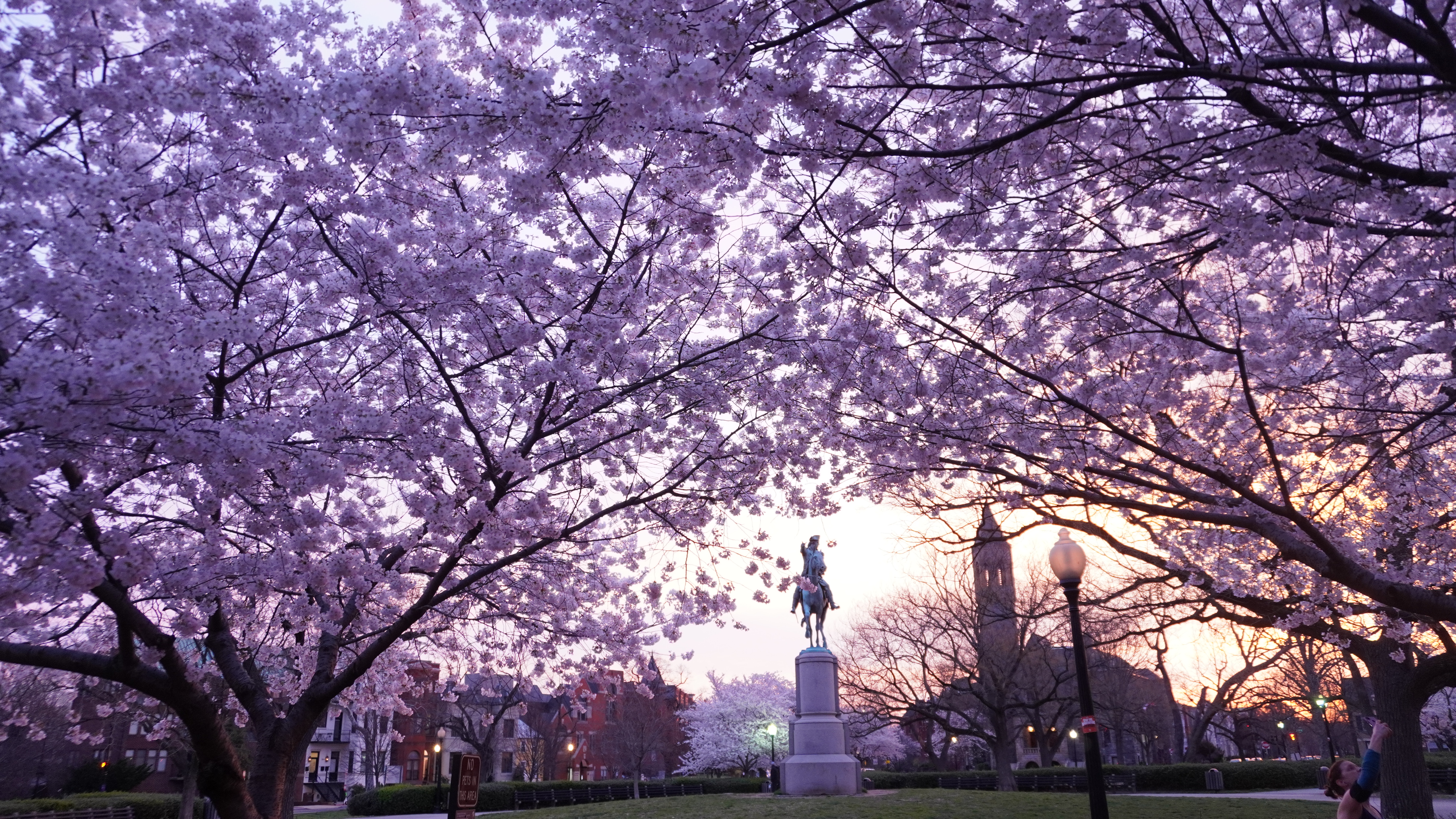
The most iconic location to view the Cherry Blossoms is obviously the Tidal Basin adjacent to the Jefferson Memorial. However, that area gets extremely crowded, and getting there by car is often a frustrating experience, unless you go very early in the morning and know where to park [Haines Point].

Nearby Haines Point is also a fabulous location see see them and depending upon the time of day, is much less crowded. There is a loop that you can bike, walk or drive. The southern most part of the loop is closed to cars until 7 am. You will have especially great views if you circumnavigate the whole loop.
It is always better to walk, Metro, or bike. Smithsonian Metro and/or L’Enfant Metro are not too far from great vistas. If you exit at L’Enfant Metro and follow this walking map [passing by the Spy Museum], you can cross over to Haines Point by bridge. https://goo.gl/maps/4q7Py9D9UkWXSH7A6
If you end up at the DC Wharf, which is a tourist destination itself, eat some seafood and/or buy a Cuban Coffee at the Colada Shop. There is also a Mexican restaurant there, Mi Vida, that has some nice outdoor seating [on three different levels], and if you go during lunch, there is a sampler menu item that is priced just right for the amount of food that you get. Otherwise, the food is very good, but a bit expensive. The Seafood Market is where all the locals go to buy seafood. One of the main vendors, just recently pulled up anchor and sailed away. Not sure where they went.
There are lots of other places to view the Cherry Blossoms. One that is nearby and frequently overlooked is Stanton Park. Though it is a very small park, the trees are spectacular and there are not large crowds to contend with.
Nearby are some great restaurants, including my favorites: Cafe Berlin [great outdoor space] and Nostra Cucina. If you amble further north to the H St. area, there are tons more great options including: Laos in Town [great outdoor space], Ethiopic, and Cane.
Further north and west, you can view them in Bethesda’s Kenwood neighborhood. I believe sometimes they bloom there a few days later than around the Tidal Basin. This year, Stanton Park seemed in peak bloom before the other areas, second was the Tidal Basin, and third was Haines Point.
Sunrise or sunset are usually the best times to view them and to take photos.
Around Lafayette Square and especially in from of the U.S. Treasury Building on 15th and Pennsylvania, there are also some very pretty trees that have gorgeous pink flowers, but are not Cherry Blossoms.
Also, the National Arboretum never disappoints.
Congressional Cemetery
Oxon Run Park – Has over 200 cherry blossom trees! Location: 1200 Mississippi Ave SE, Washington, DC 20032
Montrose Park – A great option if you have kids, because there is a playground in the park. Location: 3052 R St NW, Washington, DC 20007
Oak Hill Cemetary – It boasts not only cherry blossoms but also magnolias. Location: 3001 R St NW, Washington, DC 20007
The Basilica of the National Shrine of the Immaculate Conception Cherry Blossoms
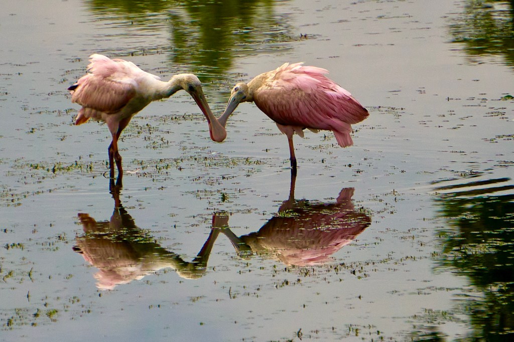
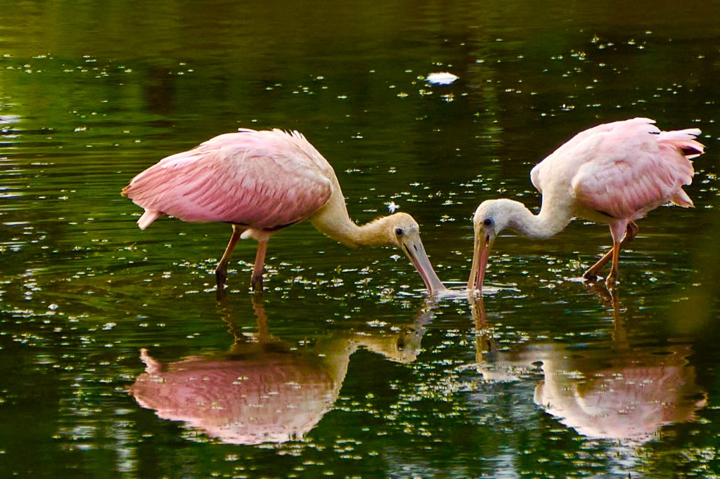
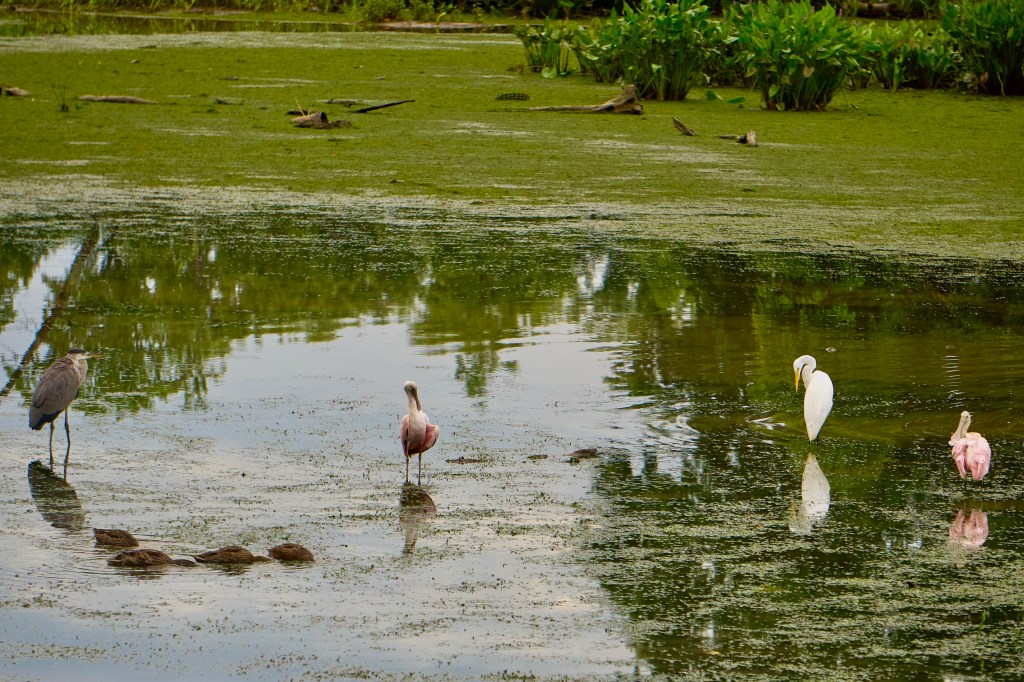
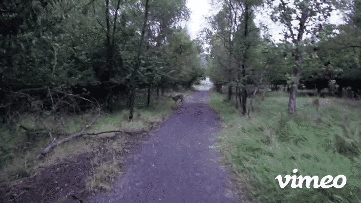
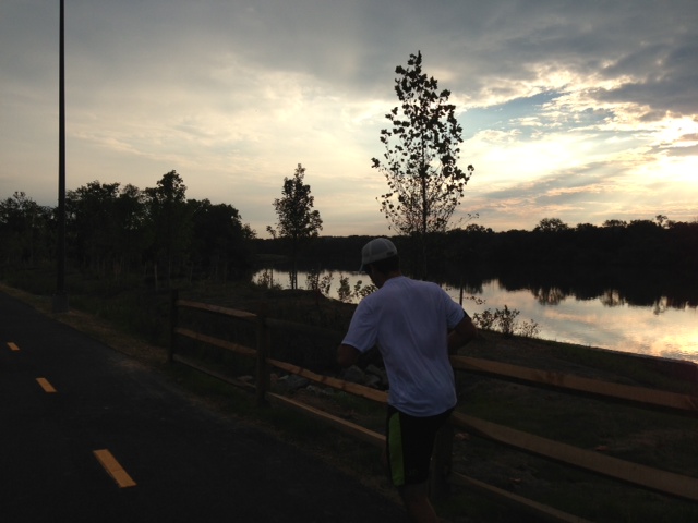
Lately, I have been biking the Anacostia River Trail in the morning. It is absolutely, one of the most spectacular urban bike trails in the U.S. While it is only a few miles from downtown, when you are on it, you almost feel transported to a rural wilderness wildlife preserve.
Some mornings, I am so eager to get on the trail, that I do not wait for the sun to rise.

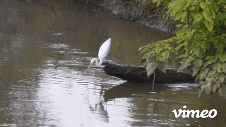
The wildlife (mostly birds, fish and deer) and the imagery (trees, wetlands, shrubs, and flowers) are fantastic.
There is a dock just south of the Bladensburg Waterfront Park that is my usual destination.
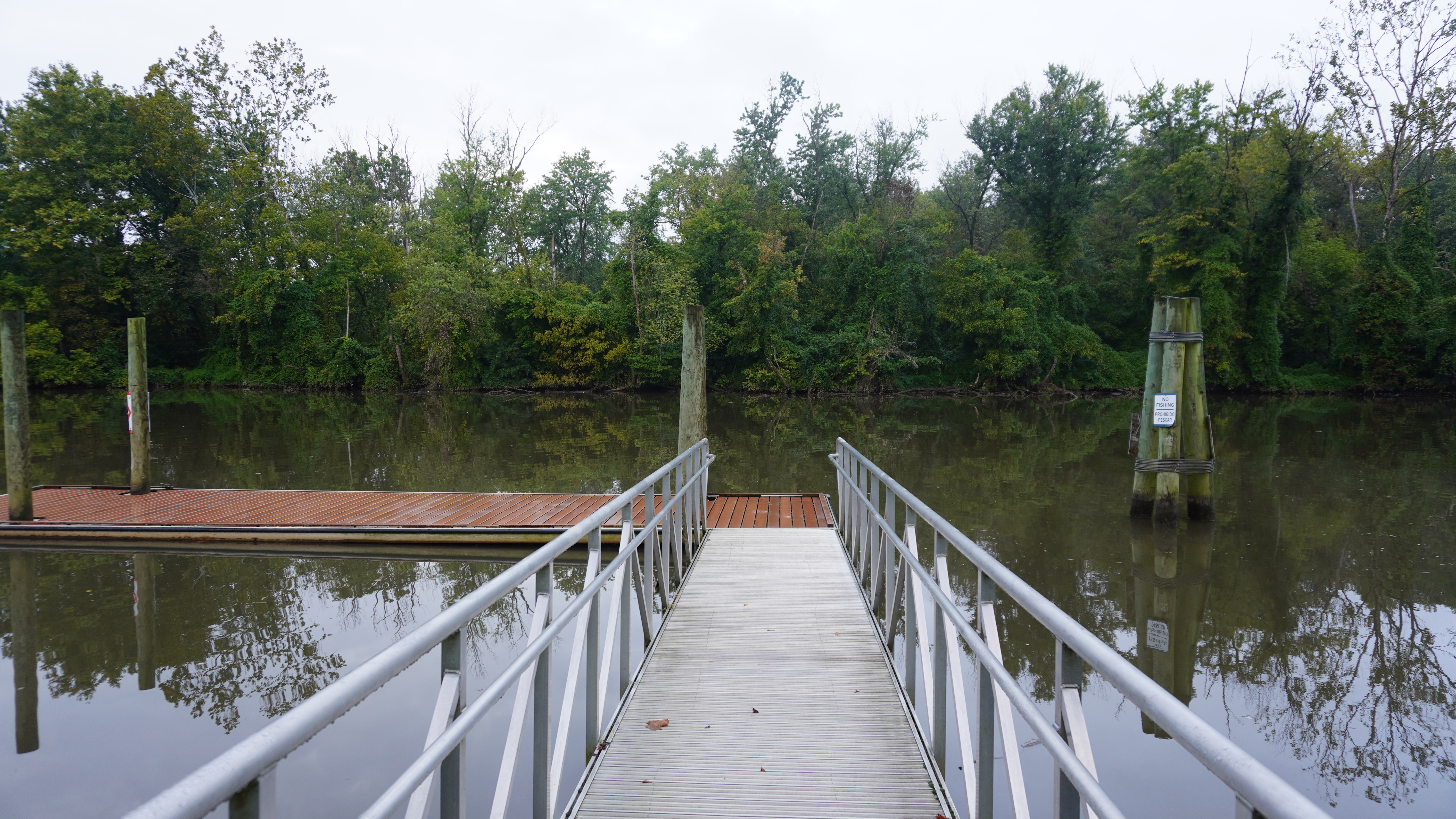
I usually bring my camera and make believe that I am on a safari, trying to capture a clear image of the herons catching a fish. The trail extends into PG county and I am always hopeful that I will have a zebra sighting.
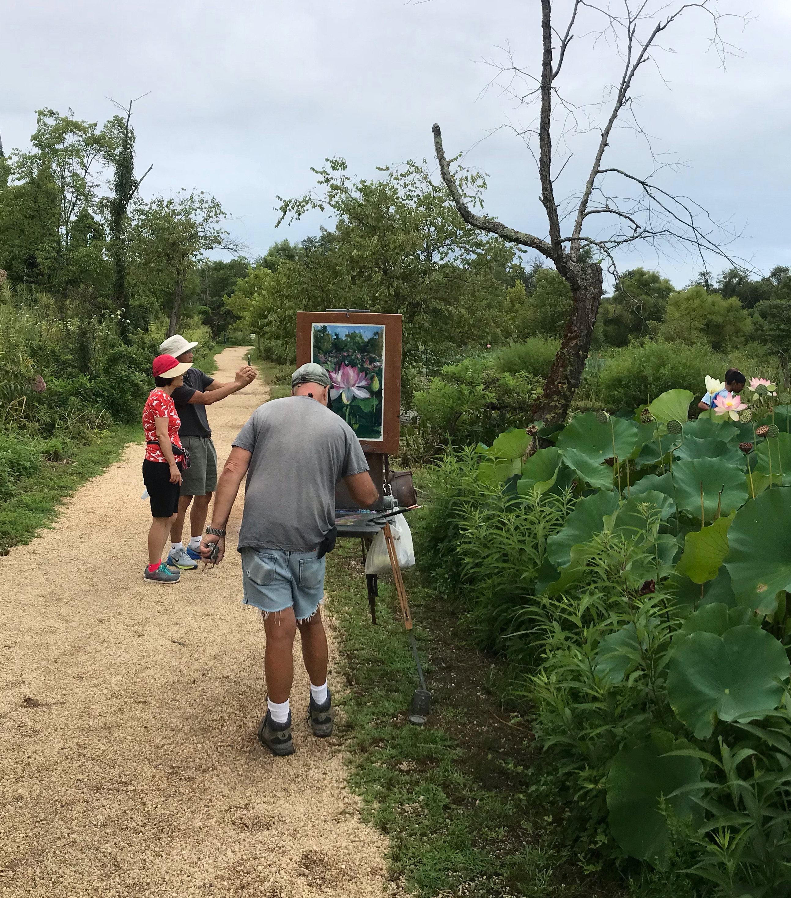
Sometimes, I visit the Kennilworth Aquatic Gardens. There is a back entrance, right from the trail.
The National Arboretum is just across the river. A pedestrian bridge is in the planning stage to connect the two.
Here is a link to my latest Anacostia River Trail videos:
Today, I completed a very nice loop on the Anacostia River Trail. I ride my bike every day, but I almost never just go out just for a ride. However, this is a great 40-60 minute loop that anyone can do very easily. If you live in DC, you should do it at least once. It is very beautiful!!
The loop I rode, is highlighted in red.
 Anacostia River Trail Loop
I started at Stanton Park, then went south and then east on Pennsylvania Ave. (passing near Eastern Market, which was not open yet), and then south on 11th St.
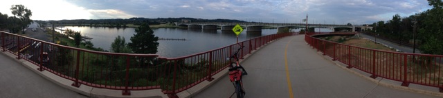
I then crossed the river on the brand new 11th St SE bridge, which has a very wide pedestrian walkway. I then arrived in a part of Anacostia that I had never before visited. I noticed also a CapitalBikeShare station (Good Hope Rd & MLK Ave SE) and a sign indicating that the Anacostia Metro station was half a mile away.
I then paralleled the river until I got to Benning Road, where there is also a CapitalBikeShare station (Anacostia Ave & Benning Rd NE / River Terrace).
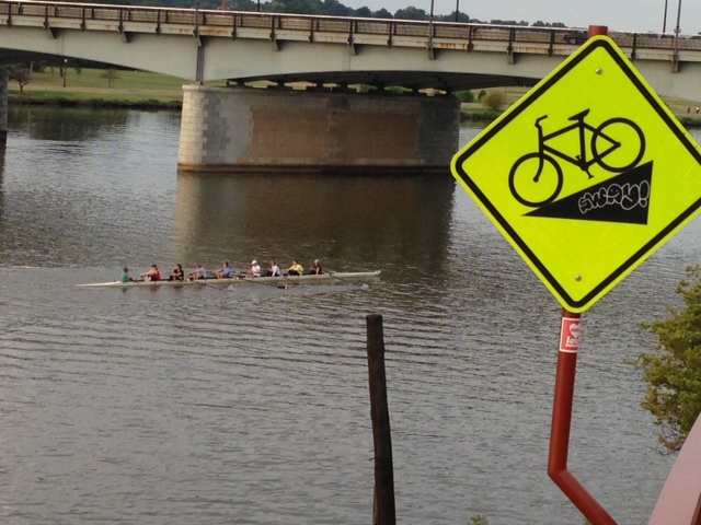
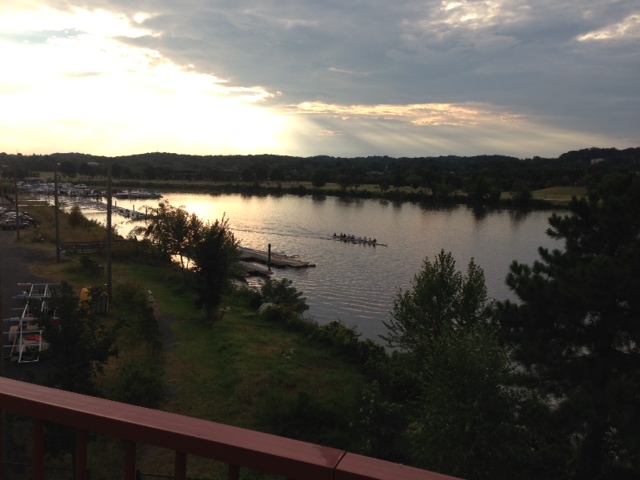
During this stretch, I saw maybe 4-5 runners and some rowers on the river. It was a gorgeous ride and I recommend it to anyone with a bike or a willingness to get on a BikeShare bike. It could take you 20-30 minutes going at a very relaxed pace. It is completely on bike path, no traffic to deal with.
I went east on south side of the sidewalk on Benning Road, and passed the entrance to Kingman Island. I then resumed on west side of the River Trail heading south past the Stadium and past the boat houses and yacht clubs where I took these photos:

For more info see: https://www.anacostiaws.org/images/Files/maps/2017_Update_ART_web.pdf
or
http://www.capitolriverfront.org/go/riverwalk-trail
I did the loop in reverse today (December 21, 2013) and made this video.
